The premise of the 4T Trail is catchy – Tour Portland on 4 Ts: Train, Trail, Tram, Trolley. I know, gimmicky but cute. And a sightseeing steal at $5 for a TriMet day pass. I finally gave it a try to see what it’s like.
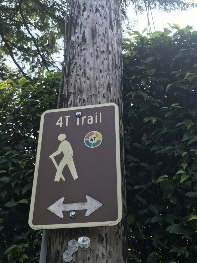
Just follow these signs
T1: The MAX Train
I have ridden the MAX train about 100 times, so this was the least thrilling T for me. I got on at the Hollywood station, since I live on the East Side. For the official 4T, you start by Pioneer Courthouse Square and head to Washington Park. This ride passes through busy downtown Portland, goes by Providence Park (home of the Timbers), drives through the Goose Hollow neighborhood, hurtles through a long, dark tunnel, then pops you out in Washington Park. Since this MAX station is by the zoo, it’s decorated with art and fun facts celebrating elephants and other animals.
T2: Trail
Despite a map and a large display right outside the MAX station describing the 4T Trail, I still had to ask for directions. And I still got lost. Seems I misinterpreted one sign to mean follow the street rather than cross the street. Suddenly I was on the Sunset Highway, which is neither safe nor scenic. When I ran out of shoulder, I had to admit that Travel Portland couldn’t possibly be recommending the highway as a walking path for tourists. So I trudged back up the onramp and tried again. I think the signage could be a tad better at this junction, and a couple of crosswalks would help, too. Anyway, I finally got on the right path that leads up to Council Crest, credited with being Portland’s highest point at 1,073 feet. Walked up a shaded trail through ferns, mossy logs and ivy-covered trees. Council Crest provides views of five surrounding mountains on a clear day. Not so clear on my walk, thanks to smoke from northern forest fires. People were lounging around on the grass, but I still had two Ts to go, so couldn’t linger.
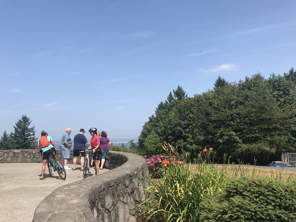
People hanging out atop Council Crest
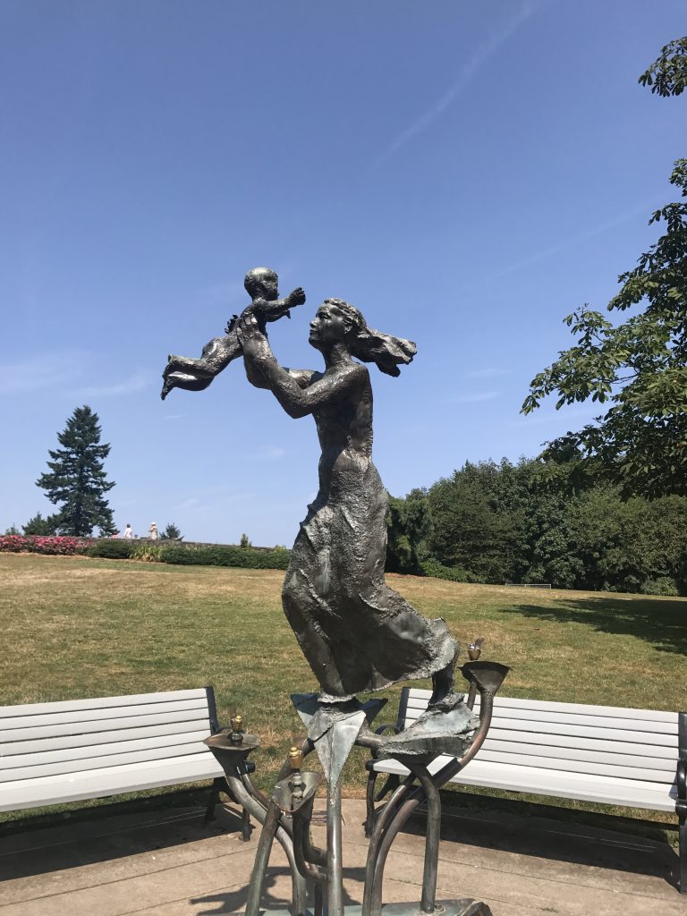
Frederick Littman’s statue “Joy” atop Council Crest doubles as a drinking fountain.
Except for that initial detour, the signs were easy to follow, leading me on the Marquam Trail through part of the Marquam Nature Park. I think you can stay on this or another trail or take a neighborhood shortcut. I accidentally took the shortcut because that’s where the 4T signs pointed. The drawback of this route is lots of blind curves with no sidewalks and minimal shoulders. I did a lot of zigzagging back and forth across the road, guessing on which side I was unlikeliest to be hit. Not recommended for children or pets. Good opportunity to check out interesting West Hills houses built over canyons.
T3: Tram
When I imagine being a tourist on the 4T, it seems a little strange that you’d wind up at Oregon Health and Sciences University, walking through hospital buildings looking for the tram. Then again, some travelers like to see a city’s less obvious attractions.
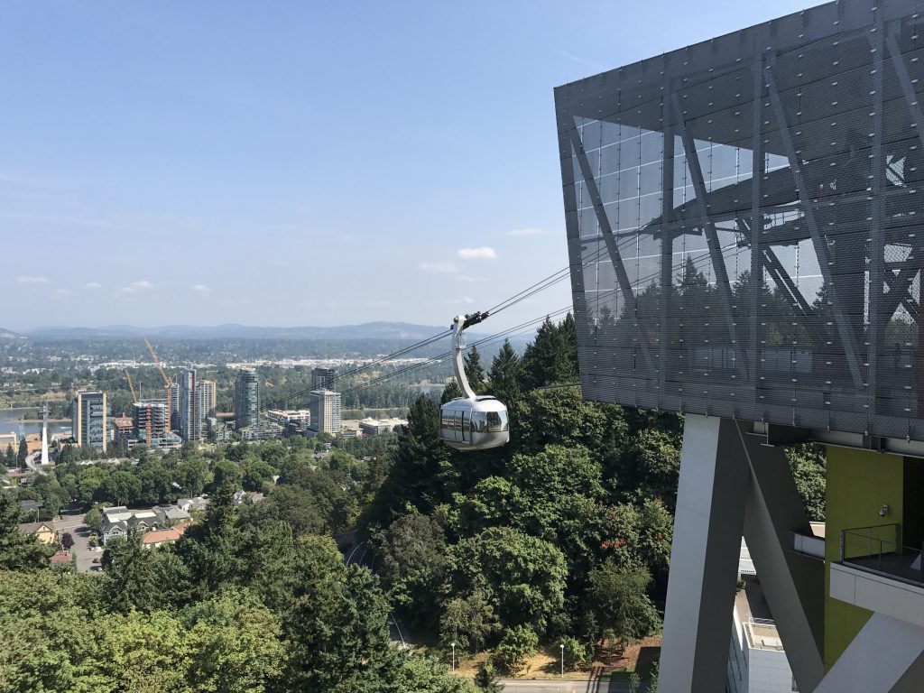
Here comes the tram!
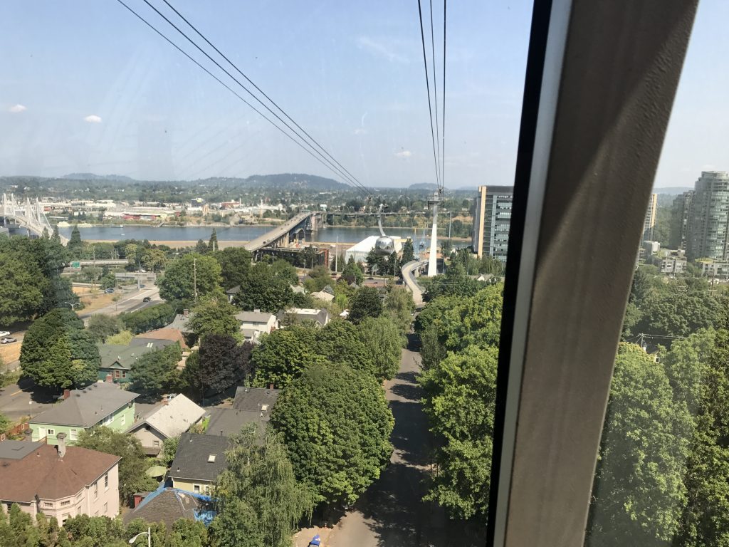
View from the tram
The OHSU tram opened in December 2006, so it’s only taken me 10 and a half years to get around to riding it. Lovely views of the river as you glide smoothly down. Made me appreciate how many wonderful old trees we have, looming over the tops of old houses.
T4: Trolley
T4 is just around the corner from where T3 lets you out. Usually known as the Portland Streetcar, here it uses the alias “trolley” to fulfill the fourth T. The trolley is a lot like the MAX. Probably fun for a visitor, but I was kind of done by then, so I just rode it a few stops.
The verdict: The 4T would be fun for cheap and/or offbeat tourists who enjoy walking and have already seen Portland’s big deal sights, or don’t care about them.